Urban Age

8arti examined two defining, intertwined features of Istanbul: its skyline and its valleys. The magnificent skyline of Istanbul’s historic peninsula is a result of the clever utilisation of its topography. In 1936, a proposal to preserve this skyline stipulated that 40 metres above sea level, no new buildings should exceed 9.5 metres in height. This principle is still in force today, and has ensured the preservation of the historic peninsula until now. However, the city’s rapid urbanisation has led to new settlements reaching the edge of the northern forests, which has almost hidden this topography with a homogeneous blanket that neglects the city’s dominant and unique geographic features and differences. The valleys act as ecological corridors that regulate air circulation within the city while they also collect and direct rainwater to the coast. However, until now those valleys have been considered as barriers for urbanisation: their riverbeds are covered and their banks are filled with, sometimes illegal, apartment blocks with insufficient infrastructure and social facilities.


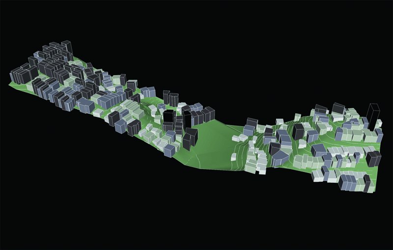
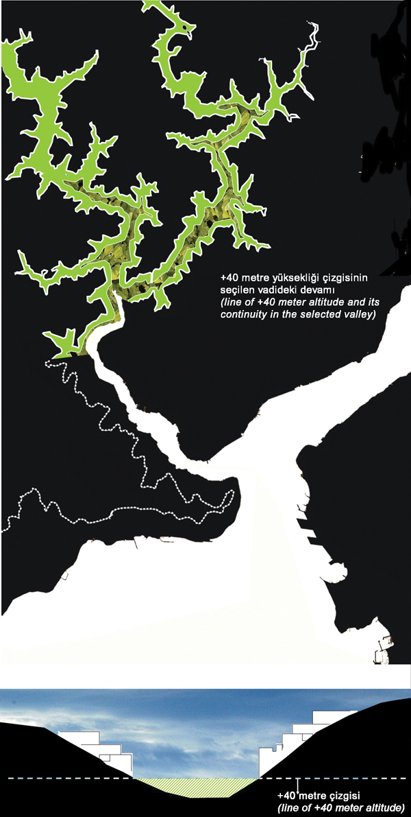
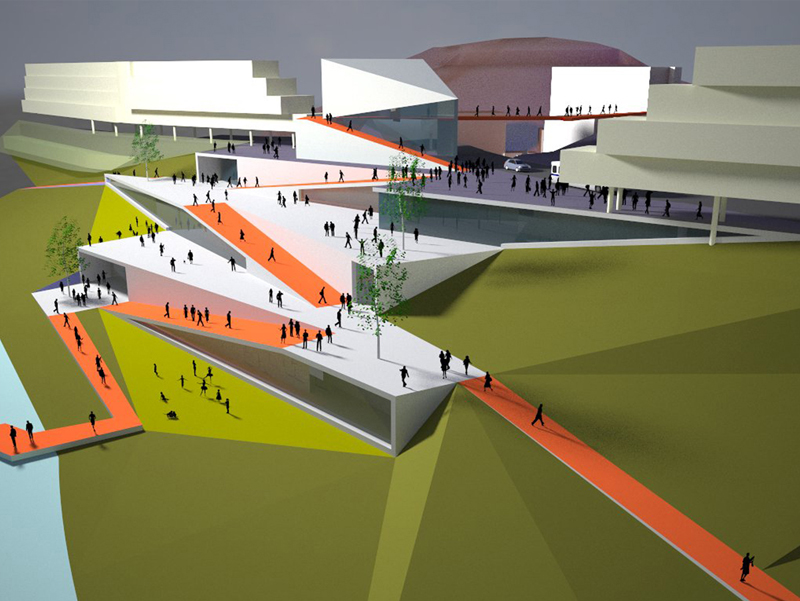
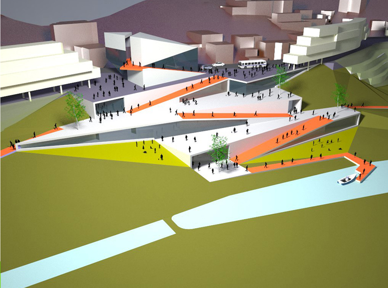
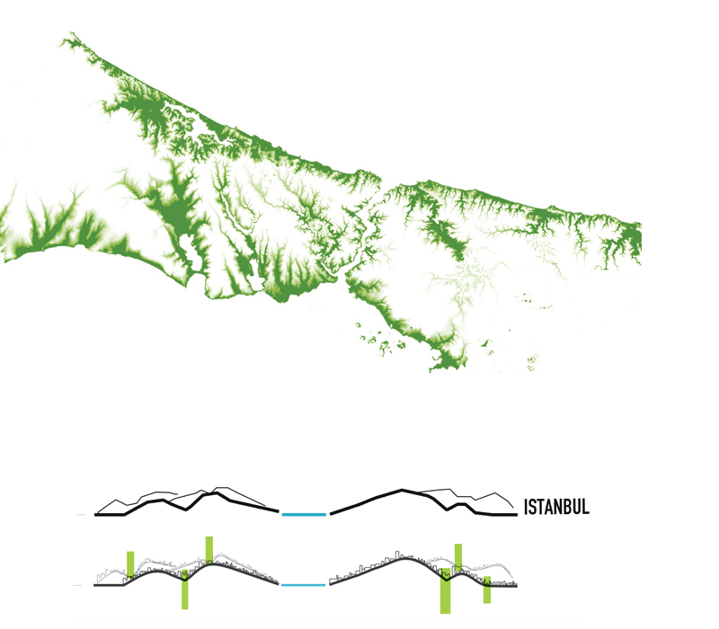
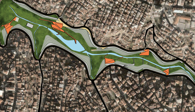
8arti chose a small valley reaching from the Levent business district to the Kagithane area as its project site. In applying an alternative 40-metre principle, 8arti proposes to clear all buildings between sea level and 40 metres above the valley basin and to transform the valley basin into a green public space. After this reclamation, the displaced population will be re-housed in the buildings to be erected above the 40-metre line above the valley basin. However, these new building settlements will be designed to accommodate an equal population and more social infrastructure with a more efficient planning code and a ‘super-social’ building for libraries, religious buildings, health and educational facilities.

Location: Istanbul
Assignment: Urban design
Size: 15 ha
Year: 2009
Status: idea / concept
Client: LSE Cities